Road Design with Civil 3D (සිංහල)
සිංහලෙන් Civil 3D ඉගෙන ගමු
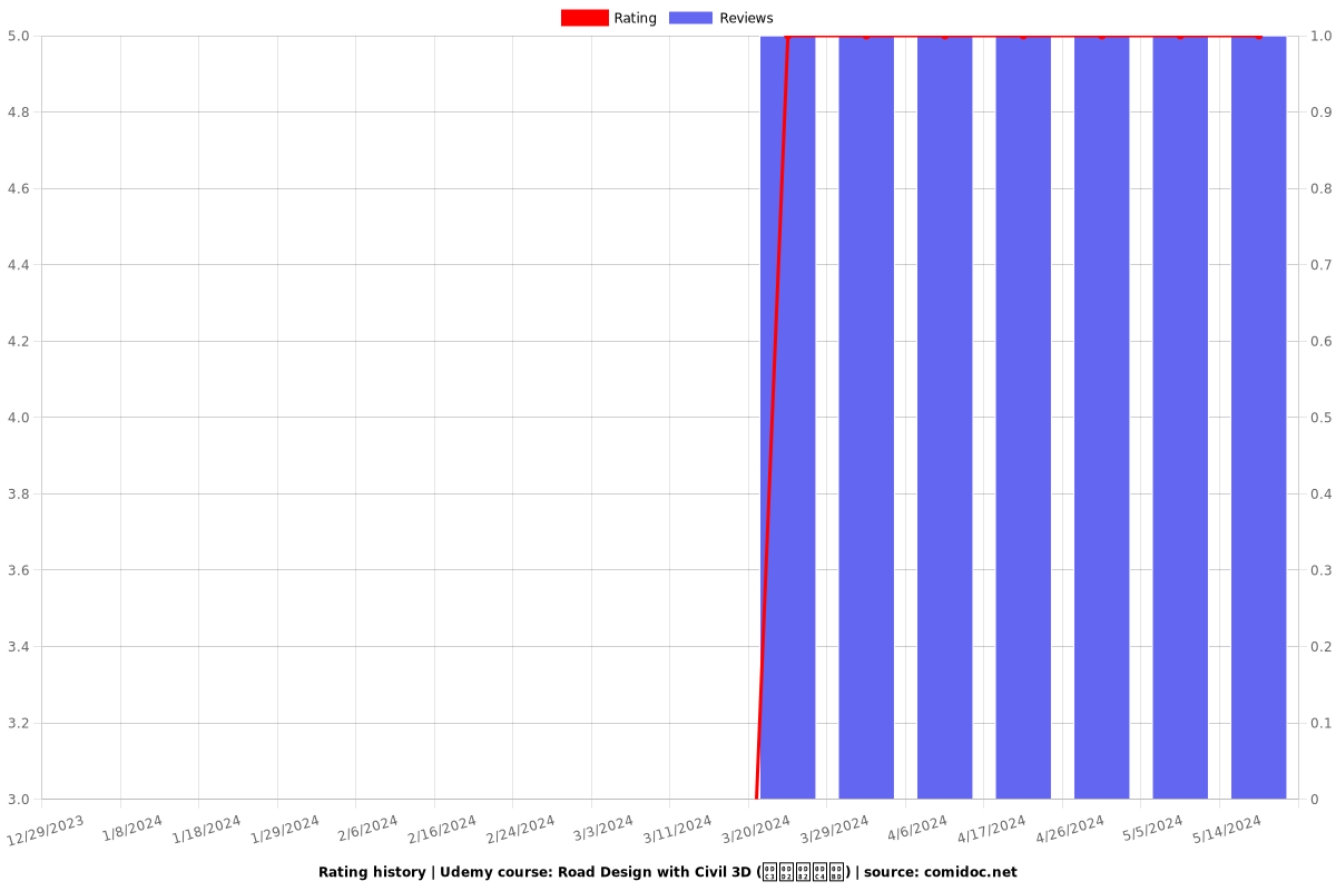
5.00 (1 reviews)

3
students
3 hours
content
Nov 2023
last update
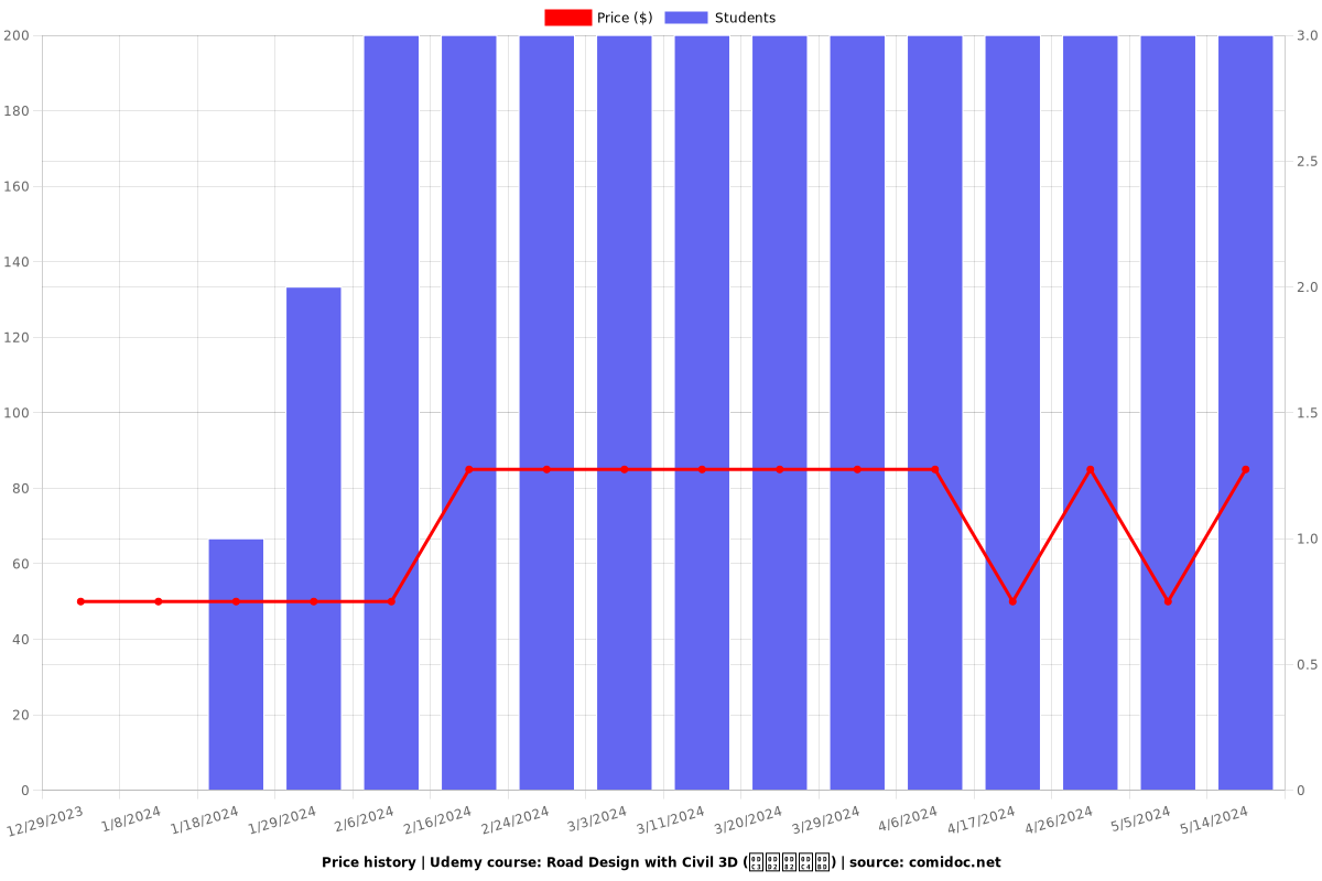
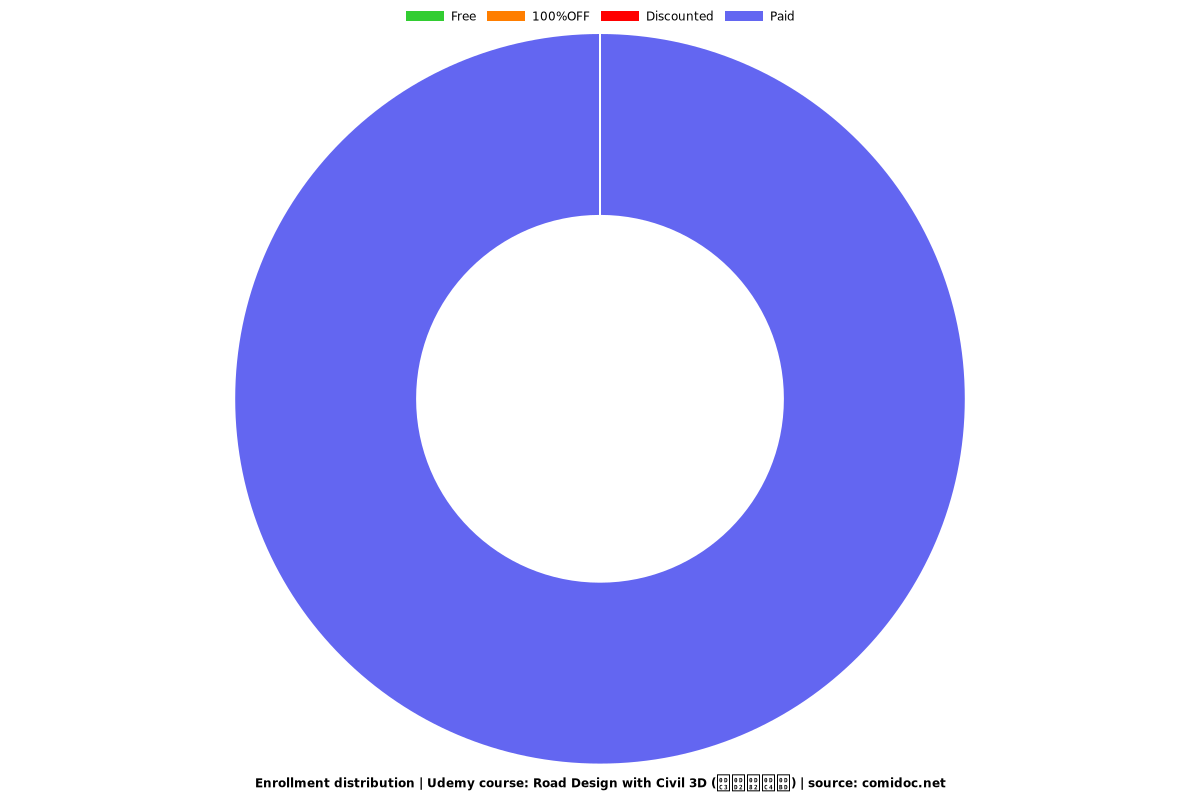
$49.99
regular price
What you will learn
AutoCAD Civil 3D මෘදුකාංගය සමඟ මාර්ගයක් සැලසුම් කරන්නේ කෙසේද?
ආධුනිකයන්ට මෙන්ම අතරමැදි පරිශීලකයින්ටද Civil 3D මෘදුකාංග සමඟ මාර්ග සැලසුම් කිරීම පිළිබඳ පැහැදිලි අවබෝධයක් ලබා ගත හැකිය.
හොඳ ඉංජිනේරුමය අවබෝධයක් සහිත සරල ඉගෙනුම් ක්රමයක් භාවිතා කෙරේ.
වඩාත් ගැඹුරු ව්යාපෘති කීරීම සඳහා හොඳ අඩිතාලමක් මෙම පාඨමාලාව හැදෑරීමෙන් ලබාගත හැක.
Why take this course?
🌟 **Road Design with Civil 3D (සිංහල) - සිංහලෙන් Civil 3D ඉගෙන ගමු**
**Curriculum Overview:**
📚 **Introduction to Road Design with AutoCAD Civil 3D**
Unlock the potential of AutoCAD Civil 3D to revolutionize your road design process. This course is designed to guide you through the creation, management, and analysis of roadway projects using the powerful features of Civil 3D.
**Understanding AutoCAD Civil 3D Interface:**
Get acquainted with the Civil 3D interface and its layout to efficiently navigate through different design functionalities. This module will familiarize you with the essential tools and commands for road design.
✅ **Mastering Civil 3D Object Styles, Label Styles, and Label Sets**
Learn to customize Object Styles, Label Styles, and Label Sets in Civil 3D to ensure precise and clear communication of design intent. These tools are crucial for creating a clean and organized drawing environment.
🖥️ **Opening a New Drawing with Civil 3D**
Start your road design project by opening a new Civil 3D drawing template specifically configured for road projects, ensuring that you have the necessary setup from the outset.
🌍 **Import Points into Civil 3D and Set External Reference for AutoCAD Drawings**
Effectively manage survey data and import points into your Civil 3D project. You'll also learn to set up external references to incorporate existing site drawings into your design.
🌱 **Create Surfaces from Points and Add Boundary to Civil 3D Surface**
Understand the process of creating surfaces from imported points, and how to define boundaries for these surfaces, which are fundamental steps in establishing a base for road alignment.
🔧 **Add Breaklines to Surface and Export to LandXML**
Learn to add breaklines to surfaces in Civil 3D to refine the shape of your design. You'll also be able to export these surfaces to LandXML format, a standard for exchanging land development data.
📋 **Open New Civil 3D Template Drawing and Import LandXML Surface into Civil 3D**
Begin a new project with a pre-configured Civil 3D template drawing to streamline your workflow. Then, import previously exported LandXML surfaces to continue your design work seamlessly.
🛣️ **Create Alignment in Civil 3D and Create Road Layout in Drawing**
Design road alignments using the alignment tools in Civil 3D, and then apply these alignments to create a detailed layout of the proposed road.
📈 **Create Profile View, Add Superelevation, and Set Data Bands**
Learn to create profile views for analysis and visualization of your road design, including the addition of superelevation where necessary. You'll also set up data bands to provide a quick reference to important information along the profile.
🏗️ **Create Assemblies, Corridors, Target Mapping, and Split Corridor**
Discover the advanced features of Civil 3D like assemblies and corridors to design complex road profiles. Learn how to perform target mapping to align with existing features and split the corridor for different design scenarios.
📐 **Create Corridor Surfaces, Sample Lines, and Section Views**
Generate corridor surfaces for a comprehensive view of your road design's volume and massing. Create sample lines and section views for detailed analysis along the corridor.
🔄 **Calculate Material Quantities**
Utilize Civil 3D to calculate material quantities for your project, which is essential for cost estimation and resource planning.
By completing this course, you will be well-equipped with the skills to design roads efficiently and accurately using AutoCAD Civil 3D, adhering to the AASHTO guidelines of 2011 and beyond. This will not only enhance your professional capabilities but also ensure compliance with industry standards in road design.
📅 **Start Date:** [Insert Course Start Date]
🎓 **Duration:** [Insert Course Duration]
🌍 **Target Audience:** Civil Engineers, Surveyors, and Road Design Professionals
👤 **Instructor:** [Civil 3D Expert/Company Name]
👉 **Register Now to secure your spot!**
Embark on your journey to master road design with AutoCAD Civil 3D. Let's pave the way for innovation and precision in civil engineering together! 🚀
Screenshots


Charts
Price
Rating
Enrollment distribution
5670908
udemy ID
11/21/2023
course created date
12/29/2023
course indexed date
Bot
course submited by