Start with Google Earth Engine & Spatial Analysis #Beginners
Get introduced to Remote Sensing and big geodata and spatial analysis in Google Earth Engine, learn basics of JavaScript

What you will learn
Students will gain access to and a thorough knowledge of the Google Earth Engine platform
Get introduced to JavaScript skills on Google Earth Engine platform
Learn how to calculate spectral indices and work with Big data on cloud
Learn image classification (land cover mapping) basics in Earth Engine Explorer
Get introduction to Remote Sensing and satellite images
Understand how to work with satellite images on the desktop computer and on the cloud
Why take this course?
Welcome to the Introduction to Google Earth Engine & Spatial Analysis for Beginners
Are you a GIS enthusiast or a budding geospatial data analyst looking to dive into the world of geospatial analysis with Big Data on the cloud? This course is tailor-made for you. We'll equip you with all the essential knowledge required to kickstart your journey into Remote Sensing and Geospatial analysis using Google Earth Engine.
Course Highlights:
Our course journey begins with a comprehensive introduction to the Earth Engine Platform. From there, we'll delve into the fundamentals of satellite imagery and image analysis, a crucial foundation for anyone venturing into Earth Engine. To ensure you're well-prepared, we'll also provide a thorough overview of JavaScript basics for spatial analysis.
Course Focus:
Please note that while we do touch on the basics of Remote Sensing, the primary focus of this course is Google Earth Engine. We'll provide you with a solid understanding of JavaScript for spatial analysis with Big Data on the Google Earth Engine cloud.
Who Is This Course For:
This course caters to beginners and those with a basic background in geospatial data, GIS, and Remote Sensing analysis. Whether you're just starting or seeking to enhance your skills, this course will set you on the right path.
Prepare for the Cloud:
Upon completing this course, you'll have the confidence to navigate and conduct spatial analysis using Big Data on Google Earth Engine. You'll also be well-prepared to leverage geospatial analysis with open-source and free software tools.
Join Us Today:
Embark on your geospatial analysis journey with Google Earth Engine and gain valuable insights into the world of spatial data analysis on the cloud. Enroll in this introductory course now and lay the foundation for your future geospatial endeavors!
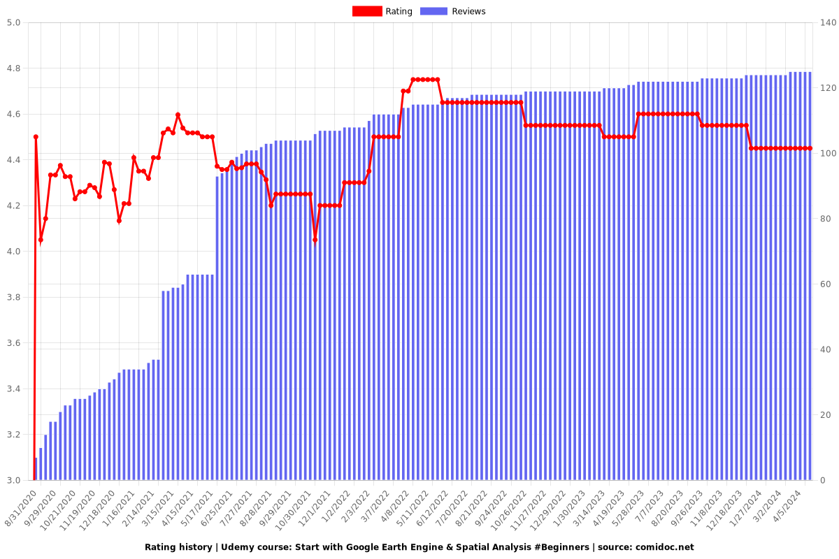
Reviews
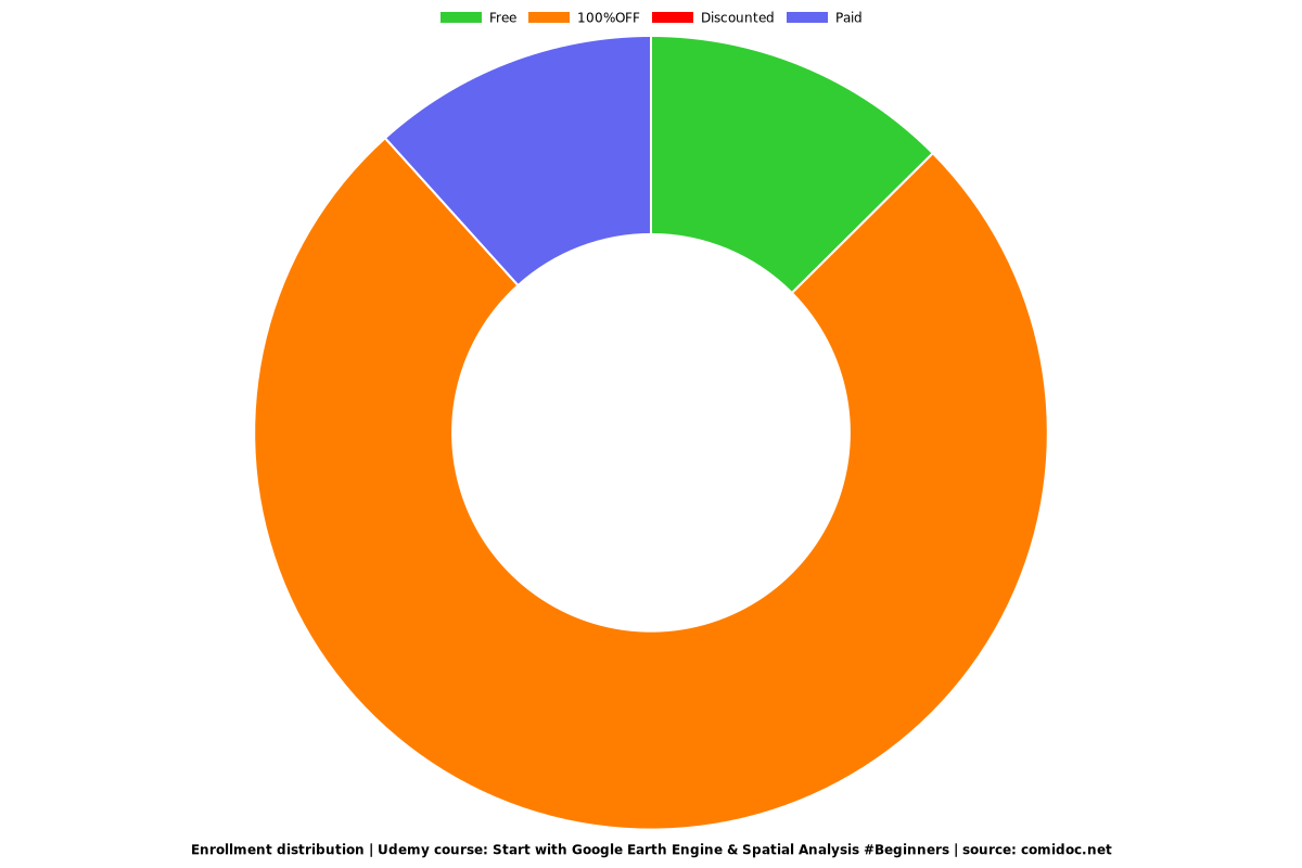
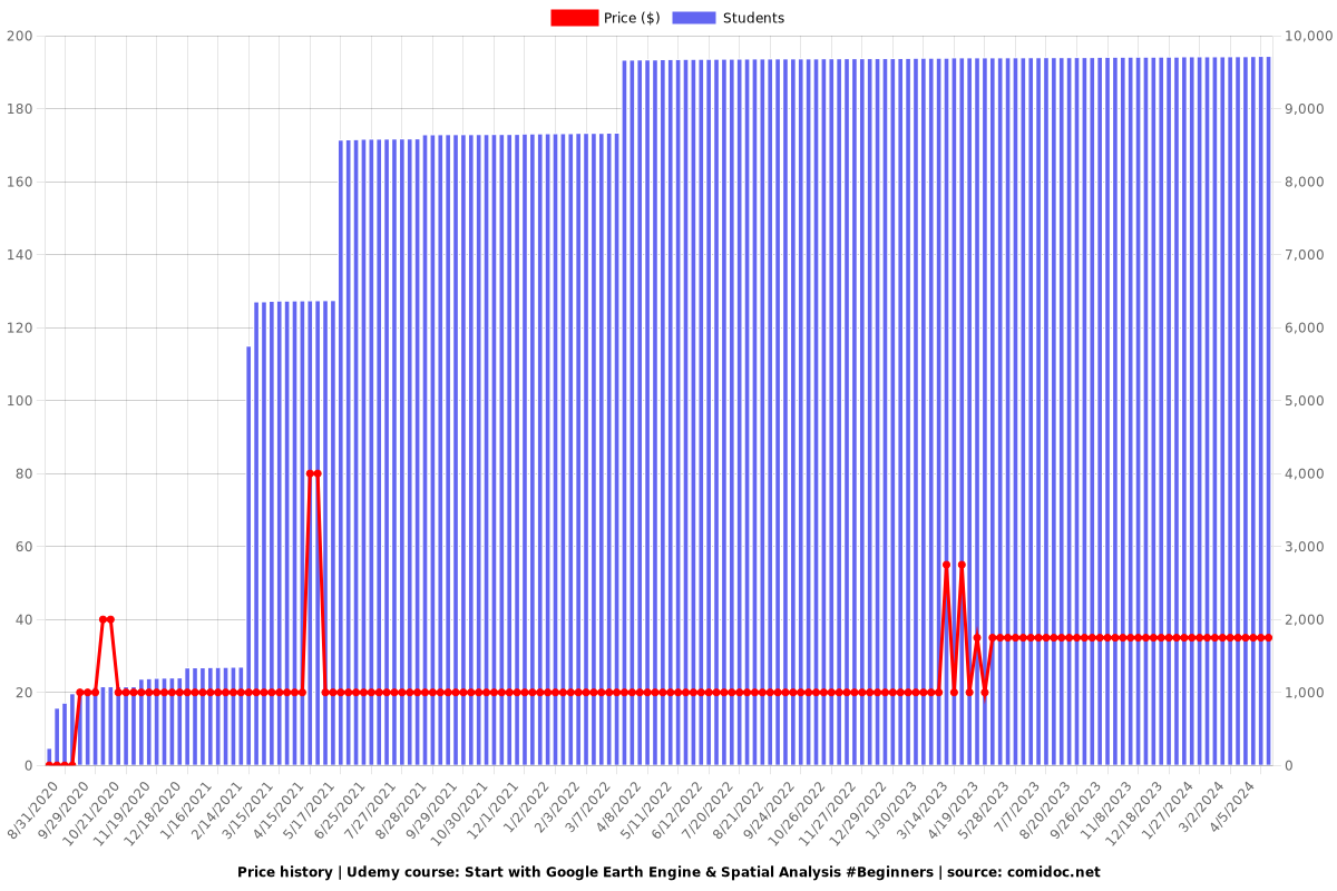
Charts
Price
Rating
Enrollment distribution