Drones in Architecture (Includes Rhino 3D Tutorial)
Join the future of Drones and Rhino 3D

What you will learn
Apply drones in architectural design
Fully use Rhino 3D
Process photo data in Agisoft Photoscan
create 3d models of structures
Why take this course?
Drones may seem like a passing fad to some, but this new technology is already having a significant impact on the way AEC professionals design and operate
The possibility to outfit drones with high-definition cameras, infrared scanners and thermal sensors allows for gathering important data that can affect a project as early as the design phase. They can survey sites, inspect construction quality and photograph completed buildings, with more powerful capabilities in sight thanks to the improvements in battery life and other features.
While using satellite imagery for site planning is common among architects, these visuals are often available in low resolution and produce less accurate data. Data collected by drones can completely eliminate the need for hiring land surveyors for creating topographic surveys. Instead, architects can use this information to build accurate 3D models of the terrain and site and import them directly into drafting and modeling software like Rhino
An Unmanned Aerial Vehicle (UAV) is an expression that identifies an aircraft that can fly without pilot; that is, an airframe and a computer system which combines sensors, GPS, servos and CPUs. All these elements combined have to pilot the plane without any human intervention. Another usual definition is that of an aircraft which is capable to fly in an autonomous way and operates in a wide range of missions and emergencies that can be controlled from a ground base station. The UAV's size, type and configuration could be different and depends on the actual application. There is no doubt today that a huge market is currently emerging from the potential applications and services that will be offered by unmanned aircrafts. More precisely, UAVs can be applied in so called “D-cube” missions [8], i.e. missions identified as Dangerous, Dirty or Dull. If we pay attention to civil applications a wide range of scenarios appears. For instance; remote environmental research, pollution assessment and monitoring, fire-fighting management, security e.g. border monitoring, agricultural and fishery applications, oceanography, communication relays for wide-band applications. In general we can divide all of these applications into four large groups: environmental applications, emergencysecurity applications, communication applications and monitoring applications. Nowadays and after many years of development, UAVs are reaching the critical point in which they could be applied in a civil/commercial scenario. However, we believe that there is a lack of hardware and software support to effectively develop such potentialities. Basically an UAV is automatically piloted by an embedded computer called the Flight Control System (FCS)[6]. This is a system that reads information from a wide variety of sensors (accelerometers, gyros, GPS, pressure sensors) and drives the UAV mission along a predetermined flight-plan.
Screenshots


Reviews
Charts
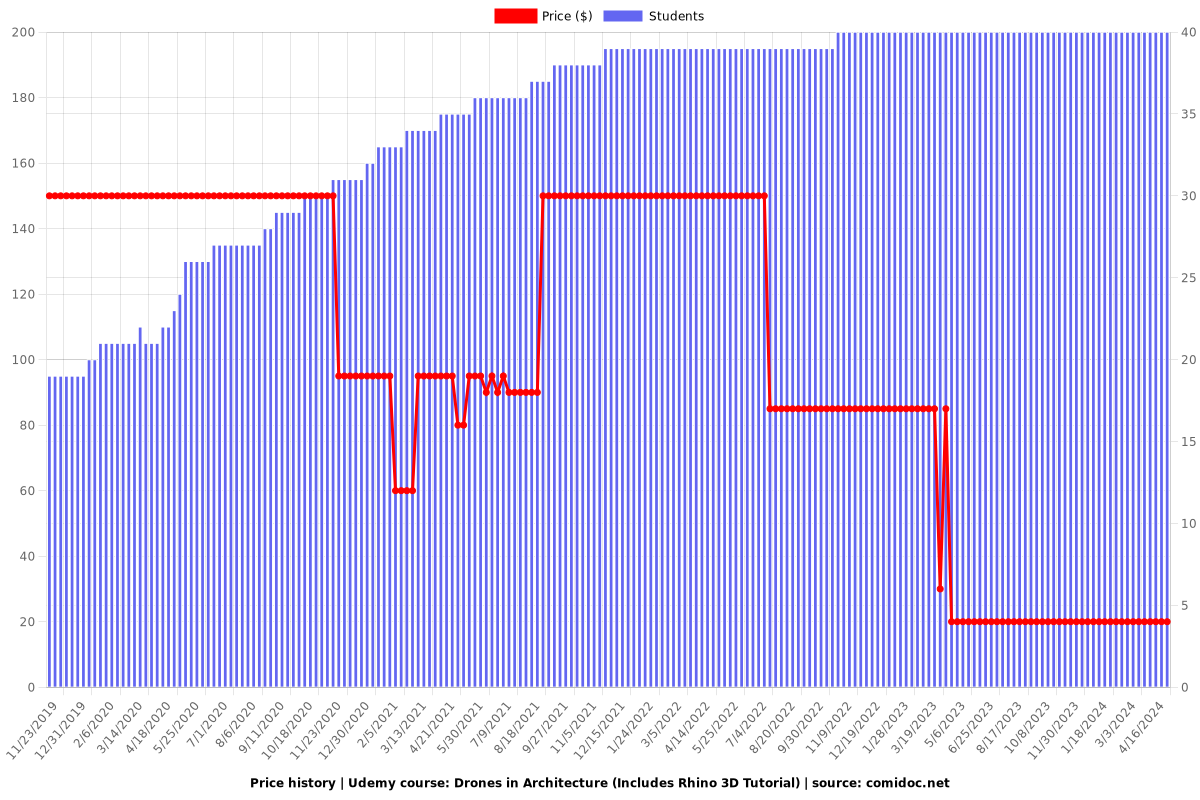
Price
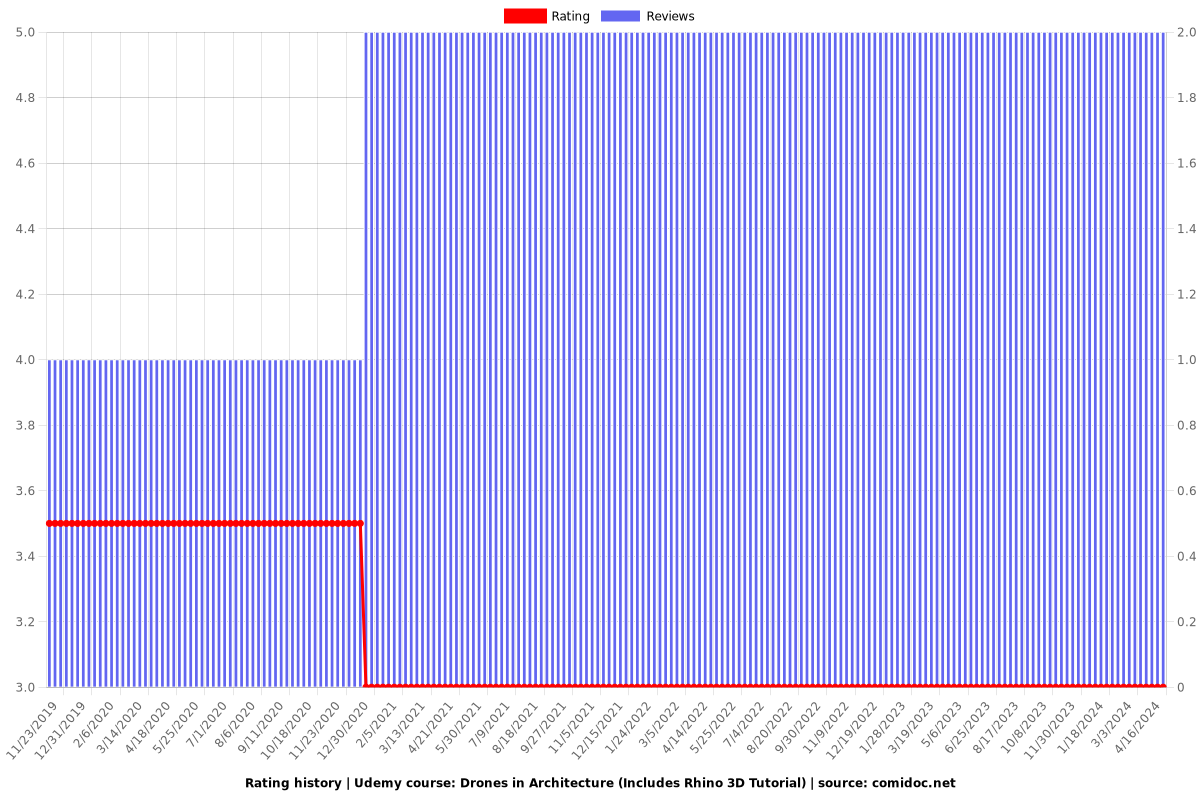
Rating
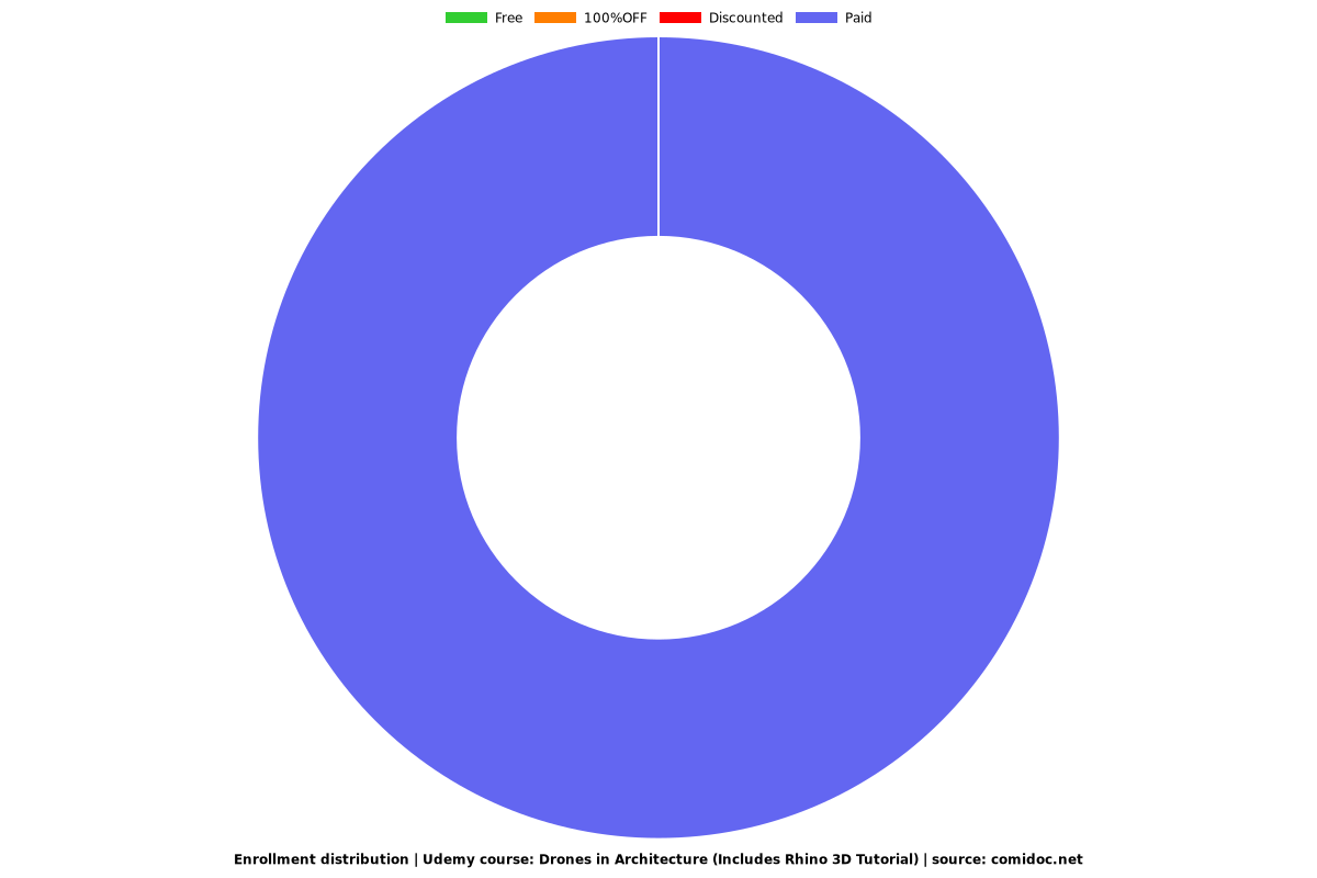
Enrollment distribution