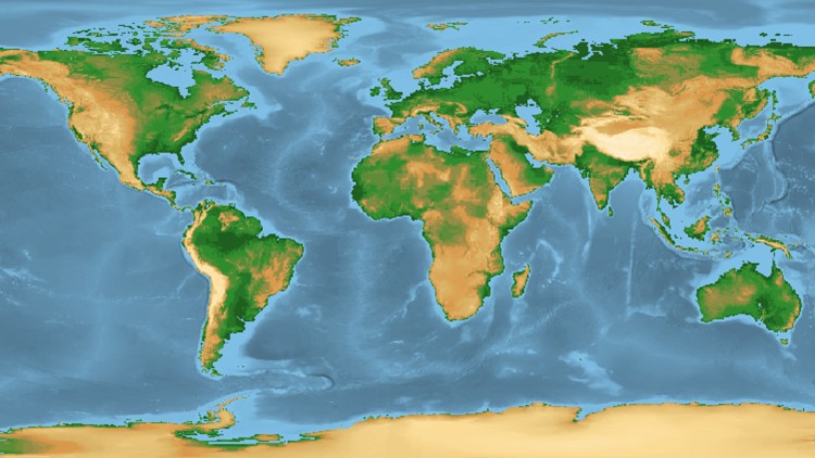
Geospatial Data Analyses & Remote Sensing: 5 Courses in 1

Remote Sensing, QGIS & GIS , main concepts, machine learning, QGIS classification, change detection, Earth Engine

4.40 (315 reviews)
Udemy
platform
English
language
Other
category
instructor
Geospatial Data Analyses & Remote Sensing: 5 Courses in 1
2,931
students
9 hours
content
Nov 2023
last update
$69.99
regular price

What you will learn

Understand and implement basic concepts of Geographic Information Systems (GIS) and Remote Sensing

Fully understand the basics of Land use and Land Cover (LULC) Mapping and Change Detection in QGIS

Learn the most popular open-source GIS and Remote Sensing software tools (QGIS), Semi-automated classification (SCP) plugin, OTB toolbox)

Learn how to obtain satellite data, apply image preprocessing, create training and validation data in QGIS

Create your first GIS maps for your reports/presentations in QGIS

Understand machine learning concepts and its application in GIS and Remote Sensing

Apply Machine Learning image classification mapping and change detection in SCP, OTB toolbox and QGIS

Fully understand and apply advanced methods in machine learning in GIS and Remote Sensing, such as random forest classification and object-based image analysis,

You'll have a copy of the labs, step-by-step manuals and scripts used in the course for QGIS & more

Why take this course?

Geospatial Analyses & Remote Sensing : from Beginner to Pro

Are you struggling to create GIS or satellite imagery-based maps for your Remote Sensing or GIS project? Do terms like Remote Sensing object-based image analysis, machine learning, QGIS, or Google Earth Engine sound daunting? Are you seeking a practical course that guides you through the concepts and helps you embark on real-life GIS mapping projects?

Welcome to our Practical Geospatial Masterclass, combining the content of four separate courses into one comprehensive learning experience. With over nine hours of video content, hands-on exercises, and downloadable materials, this course equips you with the knowledge and skills required for practical geospatial analysis. You'll learn to perform tasks such as land use and land cover mapping, change detection, machine learning for GIS, data manipulation, and map creation, all using popular and FREE software tools.

Course Highlights:

  • Comprehensive theoretical and practical geospatial knowledge

  • Application of Machine Learning in GIS and Remote Sensing

  • Land use and land cover mapping

  • Object-based image analysis

  • Data processing and map creation

  • Practical exercises with QGIS and Google Earth Engine

Course Focus:

This masterclass is designed to empower you with both theoretical and practical geospatial analysis skills, covering Remote Sensing, Geographic Information Systems (GIS), and Machine Learning applications in GIS and Remote Sensing technology. By course completion, you'll have a strong understanding of Remote Sensing and GIS fundamentals, Machine Learning applications in geospatial tasks, and the use of Machine Learning algorithms for land use and land cover mapping and object-based image analysis. Additionally, you'll be well-prepared to perform geospatial and Remote Sensing analysis using open source and free software tools.

What You'll Learn:

  • Practical use of Machine Learning algorithms in QGIS

  • Downloading and processing satellite imagery

  • Supervised and unsupervised learning

  • Accuracy assessment and change detection

  • Object-based image analysis

  • Cloud computing and Big Data analysis using Google Earth Engine

Who Should Enroll:

This course is ideal for professionals including geographers, programmers, social scientists, geologists, GIS & Remote Sensing experts, and anyone seeking to enhance their GIS and Remote Sensing skills. Whether you're a novice or looking to advance your knowledge in Machine Learning for GIS and Remote Sensing, this course provides the confidence and skills needed to tackle geospatial challenges.

INCLUDED IN THE COURSE: Gain access to precise instructions, downloadable practical materials, scripts, and datasets for hands-on geospatial analysis using QGIS and Google Earth Engine. Enroll today to unlock the power of practical geospatial analysis!

Screenshots

Geospatial Data Analyses & Remote Sensing: 5 Courses in 1 - Screenshot_01Geospatial Data Analyses & Remote Sensing: 5 Courses in 1 - Screenshot_02Geospatial Data Analyses & Remote Sensing: 5 Courses in 1 - Screenshot_03Geospatial Data Analyses & Remote Sensing: 5 Courses in 1 - Screenshot_04

Reviews

Luis
October 26, 2023
I'm currently focusing on the semi-automatic classification plugin, and the video is very clear and instructive.
Rupali
October 18, 2023
Captions not good. it is bit hard to understand the accent, but captions and transcript are not according to what is being said.
Artur
April 22, 2023
Great course: The instructor has a knack for explaining novel concepts in Remote Sensing in the simplest possible way.
Nikita
April 18, 2023
This is the best course I have ever taken being able to understand every amazing GIS concept. She is explaining all the deeper concepts that are required to be understood.
Evgeniya
September 14, 2022
A really excellent course, I am so glad that I chose this to start learning Geospatial analysis! I would recommend to anyone starting out with GIS software.
Terry
August 1, 2022
I have been going through this course avidly. The instructor is passionate and I can tell she cares very much in both the topics she is teaching and the progress of her students. This has kept me going to about the halfway mark where I must now stop and look for another course. What has made me stop the course is the lack of organization by the instructor. I am fine with lectures ending abruptly, ending with a transition for a different lecture and the theoretical lessons that are being read by the instructor from text. What I am not fine with are resources that are not compatible with the instructors practical lectures. Each time there is a practical, my progress hits a brick wall. Two major issues that I have experienced: resources linked to a lecture different than what I am watching, lack of background and assistance in *vital* tools such as the OTB. I have drawn the line in Lesson 33 because the resources do not match hers and I am not able to recreate what she is doing because of this. When I go through the Q&A, there is a very significant number of students running into the same issue. If this many students are having this issue, the instructor is obligated to consolidate the curriculum so support her students. I can see that Kate has a number of classes that can be purchased individually or as a group of them. In this process her curriculum has suffered a coherent structure and makes the practical application of her lessons unnecessarily frustrating. I am disappointed in this issue because I am enthralled by these concepts and want to implement them! Unfortunately, I will be searching for another instructor to support me on this journey. Kate has put together a massive amount of her important information. I suggest she views this body of work as a first draft and digs back into how to delivery the information more effectively. This is an incomplete curriculum in development. I believe she is very knowledgeable and capable as an analyst and instructor. I do believe she can accomplish better than this.
Stefanie
June 25, 2022
This course has really been an eye-opener for me in Remote Sensing. I will definitely recommend this to my friends and colleagues.
Maria
April 8, 2022
This was THE COURSE I was looking for. Clear, concise and practical. I can apply to real life problems immediately. Thanks for this amazing course!
Olha
February 4, 2022
That's a very comprehensive geospatial analysis course that guide you step by step. Great information!
Anna
February 4, 2022
Very useful and detailed course, high-quality teaching, detailed instructions, knowledgable instructor!
Stefanie
February 4, 2022
This course has really been an eye-opener for me in Remote Sensing. I will definitely recommend this to my friends and colleagues.
Alena
January 6, 2022
This course contains valuable and important information that it is useful both for beginners and experts.
Sabina
January 5, 2022
This is a course which fully satisfied my needs. Easy to follow the lectures of Kate, who has complete command over the Geospatial analysis subject.
Aliya
July 8, 2021
I have absolutely zero knowledge in image classification and basic knowledge in remote sensing. This course really helps me in understanding fundamental theory in geospatial analyses & remote sensing. After finishing this course, I would say, I am impressed with all of the information. Kate gave all resource & material in her course. Next, I would love to try by myself on producing a good output . Looking forward to sign up in other course. Thanks Kate.
Оксана
June 6, 2021
The course is going great so far for me. I look forward to completing it and getting support later also.

Charts

Price

Geospatial Data Analyses & Remote Sensing: 5 Courses in 1 - Price chart

Rating

Geospatial Data Analyses & Remote Sensing: 5 Courses in 1 - Ratings chart

Enrollment distribution

Geospatial Data Analyses & Remote Sensing: 5 Courses in 1 - Distribution chart

Related Topics

3095096
udemy ID
5/6/2020
course created date
5/27/2020
course indexed date
Lee Jia Cheng
course submited by