Introduction to Open Source Web GIS Programming
Lets make the digital maps. Learn about leafletjs, GeoDjango, PostGIS and GeoServer

What you will learn
Basic of mapping
Leafletjs
GeoDjango
GeoServer
CRUD functionalities for spatial data
Why take this course?
This course is mainly designed for the peoples who are highly interested in the web-mapping/web-GIS development. In this course, I mainly focused on the leaflet, GeoDjango, GeoServer, and PostGIS. Since it is a practical-based course, I directly started to write the code rather than making slides. After finishing this course, you will get a clear idea about the web-GIS and web mapping technology using open-source programming languages. Inside the course, you will find simple, effective, and alternative ways to do the tasks.
Leaflet: Leaflet is the leading open-source JavaScript library for mobile-friendly interactive maps. Weighing just about 39 KB of JS, it has all the mapping features most developers ever need.
GeoDjango: Django is a high-level Python Web framework that encourages rapid development and clean, pragmatic design. GeoDjango intends to be a world-class geographic Web framework. Its goal is to make it as easy as possible to build GIS Web applications and harness the power of spatially enabled data.
GeoServer: GeoServer implements industry-standard OGC protocols such as Web Feature Service (WFS), Web Map Service (WMS), and Web Coverage Service (WCS). Additional formats and publication options are available as extensions including Web Processing Service (WPS), and Web Map Tile Service (WMTS).
PostGIS: PostGIS is an open-source software program that adds support for geographic objects to the PostgreSQL object-relational database. PostGIS follows the Simple Features for SQL specification from the Open Geospatial Consortium.
Screenshots


Reviews
Charts
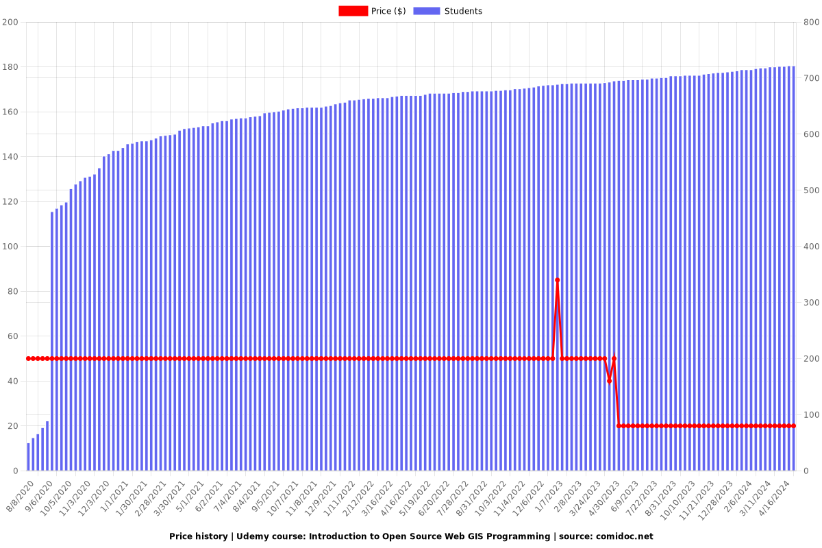
Price
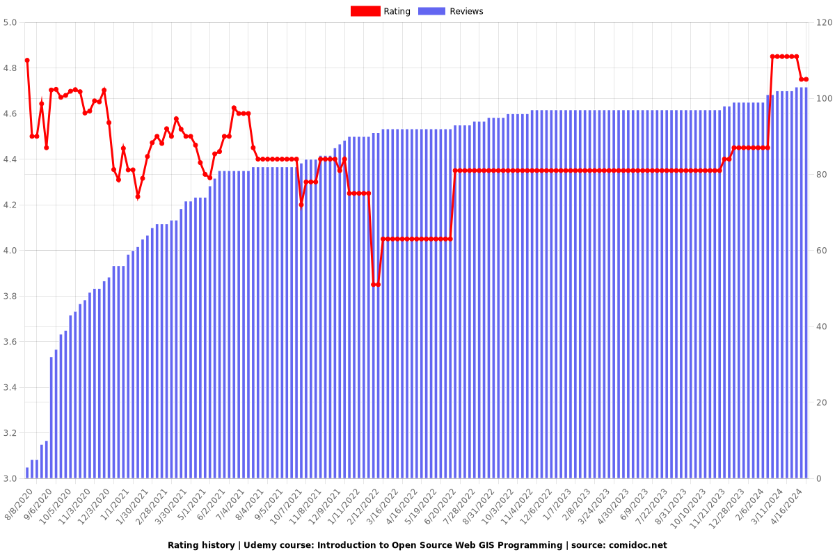
Rating
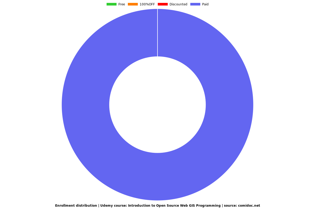
Enrollment distribution