EN.1.UAV Drones: Introduction to 3D mapping

Learn how to optimize proceses and time for engineering projects.

3.85 (67 reviews)
Udemy
platform
English
language
Photography Tools
category
EN.1.UAV Drones: Introduction to 3D mapping
729
students
1 hour
content
Nov 2016
last update
$34.99
regular price

What you will learn

Make measurements with the help of their UAV

Replace Lidar and Laser Scan devices with their UAV

Maximize results with their investment on UAV

Save lifes

Reduce Costs

Make a 3D model of buildings, people, terrain and objects

Export results to ArcGis and Autocad Civil 3D

Why take this course?

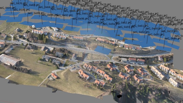
This Course is about saving time and money with the help of UAV Drones and Photogrammetry.

The course has animated presentations, stats, parameters, tips, photo and video examples of working with UAV Drones for 3D mapping.

You can complete the course in a day and take a weekend for practicing with the samples.

This course talks about what is Photogrammetry, in which Industries can be applyed, which are the business models, the ideal equipment, the leading software and UAV platforms and some safety and operational tips.

You have to take this course if you want to replace your expensive 50 topographers, 20 total station and 10 laser scanner with 1 UAV platform and photogrammetry software suite, saving money and not putting in risk your staff. It is the most profitable use of UAV.

Laser scanner and Lidar costs about $60,000 to $150,000.

A good small UAV fully autonomous starts at $1200 and photogrammetry software from $0 up to $8000 with 1cm or 2cm per pixel precision.

Screenshots

EN.1.UAV Drones: Introduction to 3D mapping - Screenshot_01EN.1.UAV Drones: Introduction to 3D mapping - Screenshot_02EN.1.UAV Drones: Introduction to 3D mapping - Screenshot_03EN.1.UAV Drones: Introduction to 3D mapping - Screenshot_04

Reviews

Leandro
March 25, 2018
Em um modo geral, faltaram mais informações complementares e a dinâmica do instrutor poderia ser melhor, como ser mais objetivo e eficiente nas explicações.
Vsevolod
December 4, 2017
Appears that the course is more like a review, with almost no demonstration, only mentioning of the various photogrammetry software without any demonstration
Art
March 3, 2017
The tools are dated, 123Capture is no longer supported. I would have liked more emphasis on good freeware products on the PC. While there is an explosion of cloud services that offer teaser photometry, then try to rope you in with monthly subscriptions, there is a need for a clean clear client-based freeware photometry product (windows, linux, Mac) and how to use it. I hope the author can update this presentation and provide that.
Liu
March 1, 2017
I think the course can include more theory, more videos, e.g" each video have at least 10 mins. Also, the background of the slide show improve. And please add more questions for the quiz. (e.g: total 15 - 20 questions)
Conrad
January 9, 2017
This course is so dry. During the first three lectures he was just stating common knowledge that I feel anyone who was interested in a class on 3D Mapping would already know. It was just very very elementary.
Gregory
October 25, 2016
Because compared to a course based in 2016, this seems to be antiquated in its ratings of drone and software for mapping.
Ricky
July 22, 2015
Great course, easy to follow and comes with practice material to try a map. Cant wait to go out and try one for myself.
Jordan
July 10, 2015
I really enjoyed this course because the on-screen sharing was a great visual for me, as I have had no prior experience with this software. I really enjoyed the NADIR examples. Course is very well structured.
Dejan
July 9, 2015
Zero useful information. Presenter barely speaks the language. None of the solutions were presented in their respective software packages. Zero practical advice.
Erez
April 11, 2015
This course is very short and as very limited value to someone who researched this subject on Google. It's really sad that Udemy takes money for something like this. Just type 'UAV mapping' on Google and you'll get many useful resources, including YouTube videos. Update: The instructor added 3 new lectures for the mapping SW: Pix4D, Photoscan and 123D. The 2 lectures for Photoscan and 123D are ok for beginners, but the Pix4D doesn't have any real material, apart from what you can already find on the Pix4D website. It will be really good to have a real short tutorial with real world drone photos.
Lucian
January 4, 2015
Course was an amazing experience to see and learn more in depth of the new business area field of UAV drones. Quality of the materials was above average and the production quality exceed my expectations. This is a must course to be taken, no regrets, only benefits.

Charts

Price

EN.1.UAV Drones: Introduction to 3D mapping - Price chart

Rating

EN.1.UAV Drones: Introduction to 3D mapping - Ratings chart

Enrollment distribution

EN.1.UAV Drones: Introduction to 3D mapping - Distribution chart
381262
udemy ID
12/31/2014
course created date
11/24/2019
course indexed date
Bot
course submited by