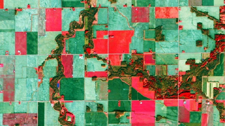
Core GIS : Land Use Land Cover & Change Detection in QGIS

Become Expert in QGIS for Geopatial data Analysis (ie. Remote Sensing & GIS ) and learn Land Use and Land Cover mapping
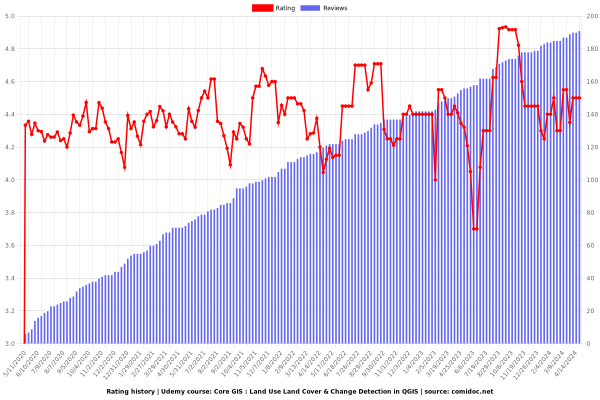
4.50 (190 reviews)
Udemy
platform
English
language
Other
category
instructor
Core GIS : Land Use Land Cover & Change Detection in QGIS
2,925
students
5 hours
content
Nov 2023
last update
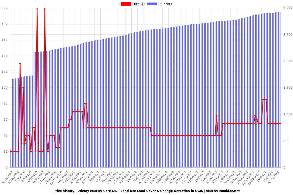
$54.99
regular price

What you will learn

Fully understand the basics of Land use and Land Cover (LULC) Mapping and Change Detection

Get an introduction and fully understand to Remote Sensing relevant for LULC mapping

Learn the most popular open-source GIS and Remote Sensing software tools (QGIS, SCP)

Pre-process and analyze Remote Sensing images in QGIS

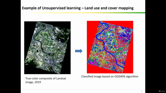
Learn about supervise and unsupervised learning in remote sensing and their applications in GIS

Learn how to obtain satellite data, apply image preprocessing, create training and validation data in QGIS

Apply Machine Learning Remote Sensing based image classification in SCP and QGIS

Apply change detection in QGIS

Create your first LULC map based on satellite imagery for your report in QGIS

You'll also have plenty of handy hints and tips that will be provided alongside the scripts for GIS & Remote Sensing analysis

You'll have a copy of the practicals step-by-step manuals used in the course for your reference

Why take this course?

QGIS and Core Remote Sensing: Land Use/Land Cover Mapping Course

Are you looking to create a land use/land cover map for your project but unsure where to start? Traditional GIS resources not meeting your practical needs? Welcome to the QGIS and Core Remote Sensing course, designed to provide you with the knowledge and skills required for practical land use/land cover (LULC) mapping and change detection using popular and free GIS software tools, specifically QGIS. This 4.5-hour course is tailored to guide you through both the theoretical and practical aspects of LULC mapping and change detection, crucial skills for Geographic Information Systems (GIS) and Remote Sensing analysts.

Course Highlights:

  • Practical LULC mapping and change detection in QGIS

  • New QGIS version

  • Theoretical and practical background

  • Acquiring and processing Remote Sensing (satellite) data

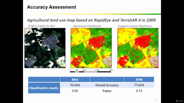
  • Accuracy assessment

  • Classification algorithms

  • Creating change maps

  • Ideal for professionals in various fields

  • Hands-on exercises in QGIS

  • Downloadable practical materials

Course Focus:

This course provides comprehensive coverage of LULC mapping and change detection in QGIS, emphasizing both theoretical foundations and practical application. By course completion, you will have a solid understanding of LULC mapping and change detection in GIS and Remote Sensing and be proficient in performing these tasks using QGIS.

What You'll Learn:

  • Installing open-source Remote Sensing and GIS software (QGIS) and configuration

  • Navigating QGIS software interface, including components and plug-ins

  • Classifying Remote Sensing (satellite) images using various machine learning algorithms in QGIS

  • Collecting training and validation data and conducting accuracy assessments

  • Performing change detection with the Semi-automated classification plug-in in QGIS

  • Preparing land cover change maps for reports

Who Should Enroll:

This course is ideal for professionals across diverse fields, including geographers, programmers, social scientists, geologists, Remote Sensing and GIS experts, and anyone needing LULC maps for their work. If you're facing tasks requiring state-of-the-art classification algorithms for land cover and land use maps, this course will equip you with the necessary skills and confidence to tackle these geospatial challenges.

INCLUDED IN THE COURSE: Access downloadable practical materials, datasets, and step-by-step instructions for practical exercises in QGIS. Enroll today to take the first step in mastering LULC mapping and change detection!

Screenshots
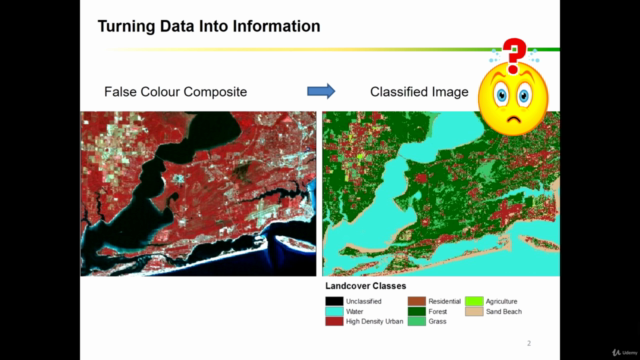
Core GIS : Land Use Land Cover & Change Detection in QGIS - Screenshot_01Core GIS : Land Use Land Cover & Change Detection in QGIS - Screenshot_02Core GIS : Land Use Land Cover & Change Detection in QGIS - Screenshot_03Core GIS : Land Use Land Cover & Change Detection in QGIS - Screenshot_04

Reviews

MBOUKOU
November 4, 2023
Petit à petit, le cours correspond à mes attentes. Heureusement que j'ai déjà fait des cours de télédétection dans le passé (2015-2017) au Maroc, car ce n'est pas facile de suivre un cours en Anglais sachant que je suis un francophone non pratiquant de la langue anglaise. Est-il possible d'avoir ce cours en Français?
Mauricio
August 10, 2023
This course was amazing for me because I could learn more about how to do the change detection, analyze the spatial-temporal change, and I also learned how to do LCLU map.
Ryan
March 6, 2023
This class is amazing, a lot of information and some of it is over my head at this point. I look forward to learning as much about Image Classification as I can and hope to implement these techniques at my job as soon as possible.
Anastasia
February 21, 2023
One of the best course I have ever taken and learned in Udemy. I would like to encourage anyone who is planning to work on Remote Sensing to take this course.
Lilit
February 21, 2023
This course is very useful for all GIS learners, easy to understand for all beginners. I learnt a lot from this course.
SNEHA
October 1, 2022
I bought this course to make my final year project. I used qgis version 3.26. Things were not working the way, she explained in her videos. I had to watch youtube videos for every other thing. It was a total waste of money. It would have been better to watch some youtube videos rather than this course as the course content is also really niche.
Jonas
January 1, 2022
Excellent course to take you trough all the steps from satellite imagery downloads up to change detection.
Mukhtar
November 26, 2021
I survived my GIS and RS master course because of this course. Its beyond my expectation and took my opensource GIS skills to the next level.
Nilesh
June 4, 2021
After goin throught the course i was confident to prepare the LULC map for my study area. the tutor also explained the every concept required to buld a map.
Bruno
March 20, 2021
I enjoyed the course and learned useful things, but sometimes I felt some hesitation and breaks in the teacher speech. Also, some text content with some errors.
Eduardo
March 7, 2021
Este curso apresenta de forma simples algumas metodologias para classificar imagens no QGis. No geral, gostei bastante do curso.
Eiliya
February 19, 2021
The language used becomes complex sometimes, but your LABS are extremely helpful. Overall this course is very informative and helpful.
Julia
February 15, 2021
Excellent course, covers theoretical and practical aspects needed to learn land use land cover classification. Very easy to follow and uses cyclic learning
Eddison
January 4, 2021
La profesora es excelente!! Es importante valorar el esfuerzo, hay que tomar muchas horas y días para crear las diapositivas, los videos etc, requiere un gran esfuerzo, por lo que felicito a la profesora por su dedicación al enseñar. Excelente capacitación
Elton
January 2, 2021
Dear Kate, Many thanks for nice course that met all my expectations. Only one thing was missing for me was that how to perform classification in any limited part of the images. You know, most cases any given study area is presented with curve shaped borders, therefore it is often needed to perform the classification in a certain part of the image, not entire image. Your speech was quite understandable and the quality of video records was fair.

Charts

Price

Core GIS : Land Use Land Cover & Change Detection in QGIS - Price chart

Rating

Core GIS : Land Use Land Cover & Change Detection in QGIS - Ratings chart

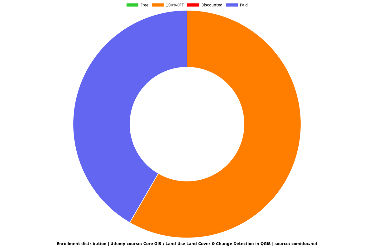
Enrollment distribution

Core GIS : Land Use Land Cover & Change Detection in QGIS - Distribution chart

Related Topics

3067068
udemy ID
4/29/2020
course created date
5/11/2020
course indexed date
Bot
course submited by